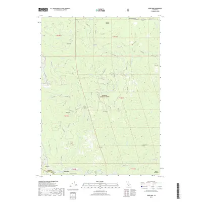
2018 Map of Somes Bar
USGS Topo · Published 2018About this map
The Salmon River and Klamath River converge in this rugged mountain landscape, marking a vital junction for the local river-and-rail history of the region. This 2018 survey detail shows Somes Bar as the primary settlement hub at the base of the Salmon Mountains, where the Old 96 route winds through the river canyon. Much of the terrain is protected as part of the Klamath National Forest, characterized by high-elevation features like Irving Mtn and Haypress Meadows. The map provides a detailed view of the complex hydrology and ridge systems that defined early travel and transport in this corner of the state, including named crossings and landmarks like Three Dollar Bar and Offield Saddle. Genealogists and local historians can trace the network of forest roads and trails, such as the Merrill Mtn Loop, that connect these remote peaks and drainages.
Find a feature on this map
45 named features on this map. Tap any name to fly to it.
Don’t see what you’re looking for? This feature index may not catch every label — zoom into the map to look around manually.
Map Details
Editions of this 2018 Somes Bar Map
This is the sole edition of this map. No revisions or reprints were ever made.
Other maps of this area

1914 · Seiad
USGS Topo · 1:125,000

1922 · Preston Peak
USGS Topo · 1:125,000

1922 · Seiad
USGS Topo · 1:125,000

1925 · Hoopa
USGS Topo · 1:125,000

1948 · Weed
USGS Topo · 1:250,000

1950 · Weed
USGS Topo · 1:250,000

1952 · Orleans
USGS Topo · 1:62,500

1955 · Dillon Mtn
USGS Topo · 1:62,500

1955 · Ukonom Lake
USGS Topo · 1:62,500

1955 · Forks of Salmon
USGS Topo · 1:62,500