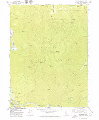
1979 Map of Somes Bar
USGS Topo · Published 1979About this map
The confluence of the Klamath River and the Salmon River serves as the focal point for this mountainous region of Northern California. Near this junction lies Somes Bar, a historic community situated along the border of Siskiyou and Humboldt counties. The map documents a landscape defined by rugged peaks and essential forestry infrastructure, featuring landmarks like the Ukonom Ranger Station and the Ishi Pishi Sch.
Find a feature on this map
43 named features on this map. Tap any name to fly to it.
Don’t see what you’re looking for? This feature index may not catch every label — zoom into the map to look around manually.
Map Details
Editions of this 1979 Somes Bar Map
This is the sole edition of this map. No revisions or reprints were ever made.
Other maps of this area

1914 · Seiad
USGS Topo · 1:125,000

1922 · Preston Peak
USGS Topo · 1:125,000

1922 · Seiad
USGS Topo · 1:125,000

1925 · Hoopa
USGS Topo · 1:125,000

1948 · Weed
USGS Topo · 1:250,000

1950 · Weed
USGS Topo · 1:250,000

1952 · Orleans
USGS Topo · 1:62,500

1955 · Dillon Mtn
USGS Topo · 1:62,500

1955 · Ukonom Lake
USGS Topo · 1:62,500

1955 · Forks of Salmon
USGS Topo · 1:62,500