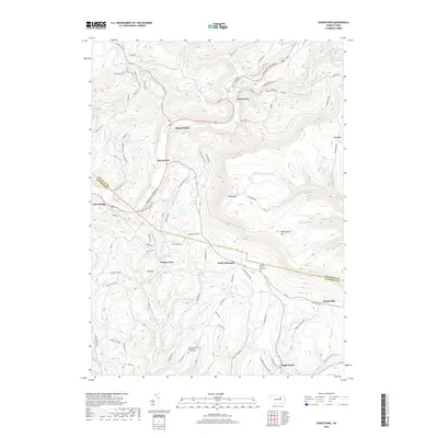
2019 Map of Sonestown
USGS Topo · Published 2019About this map
Muncy Creek and its many tributaries carve through the high elevations of Sullivan and Lycoming Counties, defining a landscape of steep ridges and narrow valleys. This area is anchored by small, enduring settlements like Sonestown and Muncy Valley, where the road network follows the natural contours of the land. The presence of several legacy burial sites, including the Franklin Stone Heap Cem and the Fairview United Methodist Church Cem, offers significant detail for those tracing local family history in this corner of Pennsylvania.
Find a feature on this map
85 named features on this map. Tap any name to fly to it.
Don’t see what you’re looking for? This feature index may not catch every label — zoom into the map to look around manually.
Map Details
Editions of this 2019 Sonestown Map
This is the sole edition of this map. No revisions or reprints were ever made.
Other maps of this area

1894 · Bloomsburg
USGS Topo · 1:62,500

1927 · Eagles Mere
USGS Topo · 1:48,000

1932 · Eagle Mere
USGS Topo · 1:62,500

1934 · Laporte
USGS Topo · 1:62,500

1935 · Hughesville
USGS Topo · 1:62,500

1947 · Benton
USGS Topo · 1:31,680
1953 · Benton
USGS Topo · 1:24,000

1953 · Hughesville
USGS Topo · 1:62,500

1953 · LaPorte
USGS Topo · 1:62,500

1953 · Eagles Mere
USGS Topo · 1:62,500
Featured Places
- Laporte Township, PA
- Biggerstown, Jordan Township
- Beaver Lake, Penn Township
- Muncy Valley, Davidson Township
- Sonestown, Davidson Township