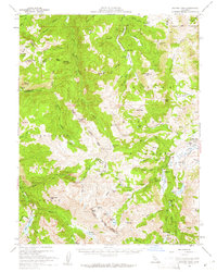
1956 Map of Sonora Pass
USGS Topo · Published 1961About this map
Sonora Pass serves as the high-altitude centerpiece of this mid-century survey, marking the dramatic boundary between the Stanislaus National Forest and the Toiyabe National Forest. The landscape is defined by the sharp divide of the Sierra crest, where Leavitt Peak and Sonora Peak tower over a network of alpine basins. To the east, the West Walker River carves through high meadows, supporting a specialized mountain economy and military presence.
Find a feature on this map
85 named features on this map. Tap any name to fly to it.
Don’t see what you’re looking for? This feature index may not catch every label — zoom into the map to look around manually.
Map Details
Editions of this 1956 Sonora Pass Map
5 editions found

Other maps of this area

1889 · Markleeville
USGS Topo · 1:125,000

1891 · Markleeville
USGS Topo · 1:125,000

1891 · Wellington
USGS Topo · 1:125,000

1893 · Markleeville
USGS Topo · 1:125,000

1893 · Wellington
USGS Topo · 1:125,000

1896 · Dardanelles
USGS Topo · 1:125,000

1898 · Dardanelles
USGS Topo · 1:125,000

1909 · Bridgeport
USGS Topo · 1:125,000

1911 · Bridgeport
USGS Topo · 1:125,000

1920 · Bridgeport
USGS Topo · 1:125,000