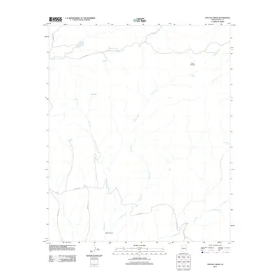
2011 Map of Sontag Creek
USGS Topo · Published 2011About this map
Dads Lookout stands as a prominent vantage point over this section of Gila County, overlooking a network of drainages and seasonal water sources. The landscape is defined by the systems of Sontag Creek and Bear Creek, which converge as they move toward the significant Bear Canyon in the south. Unlike many arid regions where water is scarce, this survey identifies numerous localized water features such as Cienega Spring, Blue River Spring, and White Tail Spring, indicating a terrain where groundwater reaches the surface at specific, historically significant points.
Find a feature on this map
23 named features on this map. Tap any name to fly to it.
Don’t see what you’re looking for? This feature index may not catch every label — zoom into the map to look around manually.
Map Details
Editions of this 2011 Sontag Creek Map
This is the sole edition of this map. No revisions or reprints were ever made.
Other maps of this area

1954 · Mesa
USGS Topo · 1:250,000

1957 · Mesa
USGS Topo · 1:250,000

1958 · Mesa
USGS Topo · 1:250,000

1960 · Mesa
USGS Topo · 1:250,000

1964 · Mesa
USGS Topo · 1:250,000

1965 · Sontag Mesa
USGS Topo · 1:24,000

1966 · Brushy Canyon
USGS Topo · 1:24,000

1966 · Natural Corral
USGS Topo · 1:24,000
1966 · Bronco Gulch
USGS Topo · 1:24,000

1966 · Popcorn Canyon
USGS Topo · 1:24,000