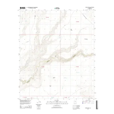
2014 Map of Sontag Mesa
USGS Topo · Published 2014About this map
The San Carlos River carves a deep, winding path through this corner of the San Carlos Apache Reservation, defining the boundary between Gila and Graham counties. This arid landscape is characterized by prominent high ground such as Sontag Mesa and the Antelope Hills, which look down upon open stretches like Warm Springs Flat and Antelope Flats. The drainage network is complex, with Blue River and Bear Cr feeding into the primary river valley.
Find a feature on this map
31 named features on this map. Tap any name to fly to it.
Don’t see what you’re looking for? This feature index may not catch every label — zoom into the map to look around manually.
Map Details
Editions of this 2014 Sontag Mesa Map
This is the sole edition of this map. No revisions or reprints were ever made.
Other maps of this area

1954 · Mesa
USGS Topo · 1:250,000

1957 · Mesa
USGS Topo · 1:250,000

1958 · Mesa
USGS Topo · 1:250,000

1960 · Mesa
USGS Topo · 1:250,000

1964 · Mesa
USGS Topo · 1:250,000

1965 · Sontag Mesa
USGS Topo · 1:24,000

1966 · Branaman Spring
USGS Topo · 1:24,000

1966 · Natural Corral
USGS Topo · 1:24,000
1966 · Bronco Gulch
USGS Topo · 1:24,000

1966 · Cassadore Spring
USGS Topo · 1:24,000