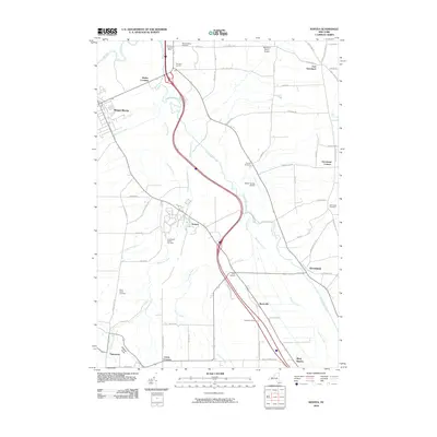
2010 Map of Sonyea
USGS Topo · Published 2010About this map
Canaseraga Creek and its many tributaries, including Keshequa Creek and Tuscarora Creek, define the drainage patterns of this Livingston County landscape. The settlement of Sonyea sits at a central crossroads, notable for the Craig State School Cemetery located nearby. To the northwest, the village of Mount Morris borders the Genesee River, while the industrial footprint of the Hampton Corners Mine marks the northern corridor near Hampton Corners.
Find a feature on this map
65 named features on this map. Tap any name to fly to it.
Don’t see what you’re looking for? This feature index may not catch every label — zoom into the map to look around manually.
Map Details
Editions of this 2010 Sonyea Map
This is the sole edition of this map. No revisions or reprints were ever made.
Other maps of this area

1901 · Honeoye
USGS Topo · 1:62,500

1902 · Wayland
USGS Topo · 1:62,500

1904 · Wayland
USGS Topo · 1:62,500

1904 · Caledonia
USGS Topo · 1:62,500

1904 · Honeoye
USGS Topo · 1:62,500

1905 · Nunda
USGS Topo · 1:62,500

1942 · Dansville
USGS Topo · 1:31,680

1942 · Conesus
USGS Topo · 1:31,680
1942 · Livonia
USGS Topo · 1:31,680

1943 · Mount Morris
USGS Topo · 1:24,000