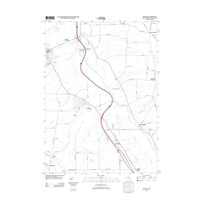
2013 Map of Sonyea
USGS Topo · Published 2013About this map
Mount Morris anchors the northwest corner of this landscape, where the Genesee River meets the industrial history of the Tail Race. The geography is defined by a dense network of watercourses including Keshequa Cr and Canaseraga Cr, which carve through the terrain near Wildcat Gully and Mill Gully. This 2013 survey provides essential documentation for genealogists, particularly through its numerous burial sites such as the Craig State Sch Cem, Williamsburg Cem, and Dutch Street Cem. The distribution of small settlements like Sonyea, Kysorville, and Tuscarora reveals the persistent rural character of Livingston County. Modern infrastructure is represented by the Seven Gullies Airport and the Mount Morris Eastbound Rest Area, showing how the region's transportation needs evolved alongside its agricultural roots.
Find a feature on this map
97 named features on this map. Tap any name to fly to it.
Don’t see what you’re looking for? This feature index may not catch every label — zoom into the map to look around manually.
Map Details
Editions of this 2013 Sonyea Map
This is the sole edition of this map. No revisions or reprints were ever made.
Other maps of this area

1901 · Honeoye
USGS Topo · 1:62,500

1902 · Wayland
USGS Topo · 1:62,500

1904 · Wayland
USGS Topo · 1:62,500

1904 · Caledonia
USGS Topo · 1:62,500

1904 · Honeoye
USGS Topo · 1:62,500

1905 · Nunda
USGS Topo · 1:62,500

1942 · Dansville
USGS Topo · 1:31,680

1942 · Conesus
USGS Topo · 1:31,680
1942 · Livonia
USGS Topo · 1:31,680

1943 · Mount Morris
USGS Topo · 1:24,000