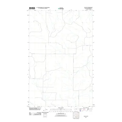
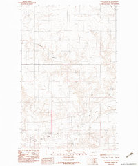
2011 Map of Soo NE
USGS Topo · Published 2011About this map
Malcolm Creek and its unnamed tributaries define the drainage patterns of this Sheridan County landscape, where the high plains are segmented by a sparse but functional network of rural roads. The geography is characterized by wide-reaching topographic contours that indicate the gentle rise and fall of the Montana prairie. Settled activity is centered on family-named corridors such as Bolster Rd and Welliver Rd, which likely represent long-standing local ranching or agricultural access points. In the southwest corner, the winding path of Wolf Creek cuts through the terrain, while routes like 2 Tree Rd and Malcolm Creek Rd provide the primary infrastructure for the Brockton District. This 2011 survey captures the area's enduring reliance on creek-fed valleys and established section-line roads.
Find a feature on this map
8 named features on this map. Tap any name to fly to it.
Don’t see what you’re looking for? This feature index may not catch every label — zoom into the map to look around manually.
Map Details
Editions of this 2011 Soo NE Map
This is the sole edition of this map. No revisions or reprints were ever made.
Other maps of this area

1954 · Wolf Point
USGS Topo · 1:250,000

1958 · Wolf Point
USGS Topo · 1:250,000

1983 · Redstone
USGS Topo · 1:24,000

1983 · Kisler Butte
USGS Topo · 1:24,000
1983 · Flagstaff Hill
USGS Topo · 1:24,000

1983 · Soo NW
USGS Topo · 1:24,000

1983 · Archer
USGS Topo · 1:24,000
1983 · Thornwood Ranch
USGS Topo · 1:24,000
1983 · Soo NE
USGS Topo · 1:24,000
1983 · Plentywood SW
USGS Topo · 1:24,000