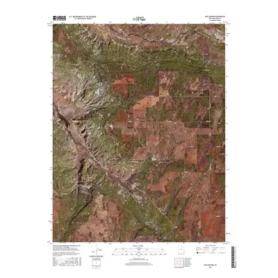
2017 Map of Sop Canyon
USGS Topo · Published 2017About this map
Sop Canyon and its many tributary drainages define this high-altitude landscape in San Juan County. This 2017 survey details the complex topography of the plateau, characterized by named rises such as Deerneck Mesa and Three Step Hill, alongside deep cuts like Iron Spring Canyon and Bear Trap Canyon. A critical water source, Sop Spring, is noted among the arid terrain, illustrating the sparse but vital hydrography of the region.
Find a feature on this map
31 named features on this map. Tap any name to fly to it.
Don’t see what you’re looking for? This feature index may not catch every label — zoom into the map to look around manually.
Map Details
Editions of this 2017 Sop Canyon Map
This is the sole edition of this map. No revisions or reprints were ever made.
Other maps of this area

1885 · La Sal
USGS Topo · 1:250,000

1886 · Abajo
USGS Topo · 1:250,000

1892 · Abajo
USGS Topo · 1:250,000

1893 · Abajo
USGS Topo · 1:250,000

1954 · Mt Peale 4 NE
USGS Topo · 1:24,000

1954 · Mt Peale 4 NW
USGS Topo · 1:24,000

1954 · Mt Peale 3 NE
USGS Topo · 1:24,000

1954 · Mt Peale 3 SE
USGS Topo · 1:24,000
1954 · Mt Peale 4 SE
USGS Topo · 1:24,000

1954 · Mt Peale 4 SW
USGS Topo · 1:24,000