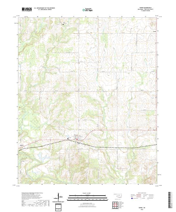
2022 Map of Soper
USGS Topo · Published 2022About this map
Soper and its surrounding Choctaw County landscape are defined by a network of winding tributaries that converge toward the Muddy Boggy Creek bottomlands. The town itself is organized around a grid including Main St, Williams Ave, and Washington St, reflecting the traditional layout of a small Oklahoma prairie community. To the north, the terrain rises toward the Sugar Creek Cem and the small settlement of Kent, while the western edge of the map identifies the area of Jasper. The prevalence of family and community landmarks like Soper Cem and the numerous named creeks, including Bokchito Cr and Crowder Cr, suggests a landscape where geography and local history are deeply intertwined. The inclusion of Colbert Lake in the southern portion further highlights the importance of water resources in this part of the state.
Find a feature on this map
50 named features on this map. Tap any name to fly to it.
Don’t see what you’re looking for? This feature index may not catch every label — zoom into the map to look around manually.
Map Details
Editions of this 2022 Soper Map
This is the sole edition of this map. No revisions or reprints were ever made.
Other maps of this area

1901 · Antlers
USGS Topo · 1:125,000

1903 · Paris
USGS Topo · 1:125,000

1912 · Antlers
USGS Topo · 1:125,000

1925 · Antlers
USGS Topo · 1:125,000

1948 · Grant
USGS Topo · 1:62,500

1948 · Direct
USGS Topo · 1:62,500

1949 · Direct
USGS Topo · 1:62,500

1949 · Grant
USGS Topo · 1:62,500

1950 · Mcalester
USGS Topo · 1:250,000

1953 · Texarkana
USGS Topo · 1:250,000