
1971 Map of Soperton North
USGS Topo · Published 1973About this map
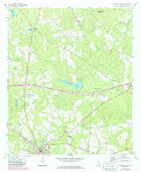
Soperton anchors the southwestern corner of this coastal plain landscape in the early 1970s, where the Seaboard Coast Line railroad meets a network of local roads. The survey documents a transition in infrastructure, most notably a major highway labeled Under Construction that arcs across the center of the sheet, bisecting the drainage basins of Pendleton Creek and Alligator Creek. This era of modernization is juxtaposed with older community landmarks, including the County School and numerous rural sanctuaries such as Johnson Chapel Cem and Rock Hill Ch. The terrain is defined by low-lying wetlands and sandy rises like Sand Hill, with several small water bodies including Sand Hill Lake and Herman Pond scattered throughout the drainage systems of Rocky Creek and Bobtail Creek.
Find a feature on this map
41 named features on this map. Tap any name to fly to it.
Don’t see what you’re looking for? This feature index may not catch every label — zoom into the map to look around manually.
Map Details
Editions of this 1971 Soperton North Map
2 editions found
Other maps of this area

1957 · Macon
USGS Topo · 1:250,000

1958 · Macon
USGS Topo · 1:250,000

1964 · Macon
USGS Topo · 1:250,000

1970 · Oak Park SW
USGS Topo · 1:24,000

1970 · Covena
USGS Topo · 1:24,000

1971 · Norristown
USGS Topo · 1:24,000

1971 · Soperton South
USGS Topo · 1:24,000

1971 · Lothair
USGS Topo · 1:24,000

1971 · Rockledge
USGS Topo · 1:24,000

1974 · Scott
USGS Topo · 1:24,000