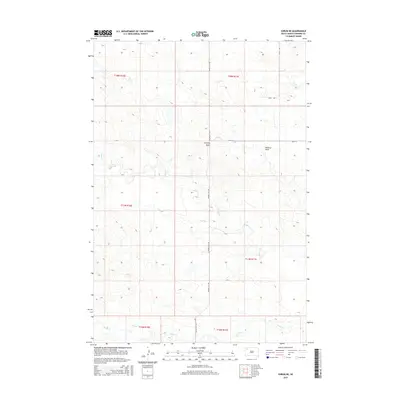
2015 Map of Sorum NE
USGS Topo · Published 2015About this map
Chimney Butte stands as a primary landmark in this section of Perkins County, overlooking a landscape defined by intermittent watercourses and high plains drainage. The terrain is carved by the meandering path of Rabbit Cr, which is joined by local tributaries including Bog Cr and Peggy Cr. These waterways form the backbone of the local topography, alongside the distinct depression of Mallory Draw.
Find a feature on this map
14 named features on this map. Tap any name to fly to it.
Don’t see what you’re looking for? This feature index may not catch every label — zoom into the map to look around manually.
Map Details
Editions of this 2015 Sorum NE Map
This is the sole edition of this map. No revisions or reprints were ever made.
Other maps of this area

1954 · Lemmon
USGS Topo · 1:250,000

1957 · Lemmon
USGS Topo · 1:250,000

1983 · Grandmas Butte
USGS Topo · 1:24,000

1983 · Sorum NE
USGS Topo · 1:24,000
1983 · Sorum
USGS Topo · 1:24,000

1983 · Date
USGS Topo · 1:24,000

1983 · Sorum SE
USGS Topo · 1:24,000

1983 · Daviston
USGS Topo · 1:24,000
1983 · White Hill
USGS Topo · 1:24,000
1983 · Sorum SW
USGS Topo · 1:24,000