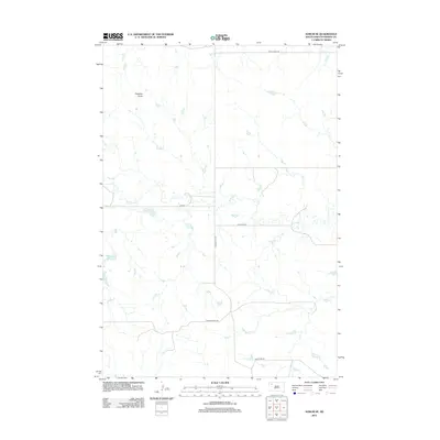
2012 Map of Sorum SE
USGS Topo · Published 2012About this map
Haystack Butte rises above the drainage basins of western South Dakota in this 2012 U.S. Geological Survey representation of Perkins County. The landscape is defined by a dendritic network of seasonal waterways, most notably the winding paths of Antelope Cr and Dog Cr. This region of the Great Plains maintains a sparse, grid-based transportation network, reflecting a late-modern era of ranching and remote rural settlement. Primary thoroughfares such as Prairie City Rd and Antelope Rd provide the essential framework for navigating the expansive grasslands between isolated points of interest. The lack of concentrated urban development on this sheet highlights the enduring agricultural character of the territory, where terrain features like the butte serve as primary navigational markers in an otherwise uniform environment of drainages and section-line roads.
Find a feature on this map
9 named features on this map. Tap any name to fly to it.
Don’t see what you’re looking for? This feature index may not catch every label — zoom into the map to look around manually.
Map Details
Editions of this 2012 Sorum SE Map
This is the sole edition of this map. No revisions or reprints were ever made.
Other maps of this area

1951 · Imogene
USGS Topo · 1:24,000

1954 · Lemmon
USGS Topo · 1:250,000

1957 · Lemmon
USGS Topo · 1:250,000

1980 · Zeona
USGS Topo · 1:25,000

1983 · Sorum NE
USGS Topo · 1:24,000
1983 · Sorum
USGS Topo · 1:24,000

1983 · Date
USGS Topo · 1:24,000

1983 · Sorum SE
USGS Topo · 1:24,000

1983 · Daviston
USGS Topo · 1:24,000
1983 · Sorum SW
USGS Topo · 1:24,000