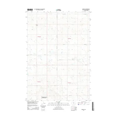
2015 Map of Sorum SE
USGS Topo · Published 2015About this map
Haystack Butte rises as a prominent landmark in this section of Perkins County, overlooking a landscape defined by the drainage patterns of Antelope Cr and Dog Cr. The map captures the highly structured Public Land Survey System of the rural West, with sectional boundaries and townships like t16n r10e and t15n r11e clearly delineated. A significant portion of the southern area is identified as the Unorganized Territory of Wyandotte, highlighting the persistence of unique administrative divisions in South Dakota's interior. A network of rural section-line roads, including Prairie City Rd, Peggy Creek Rd, and Antelope Rd, provides the primary framework for local travel across these open grasslands. This survey reflects the enduring cattle-ranching and agricultural character of the region in the early twenty-first century.
Find a feature on this map
16 named features on this map. Tap any name to fly to it.
Don’t see what you’re looking for? This feature index may not catch every label — zoom into the map to look around manually.
Map Details
Editions of this 2015 Sorum SE Map
This is the sole edition of this map. No revisions or reprints were ever made.
Other maps of this area

1951 · Imogene
USGS Topo · 1:24,000

1954 · Lemmon
USGS Topo · 1:250,000

1957 · Lemmon
USGS Topo · 1:250,000

1980 · Zeona
USGS Topo · 1:25,000

1983 · Sorum NE
USGS Topo · 1:24,000
1983 · Sorum
USGS Topo · 1:24,000

1983 · Date
USGS Topo · 1:24,000

1983 · Sorum SE
USGS Topo · 1:24,000

1983 · Daviston
USGS Topo · 1:24,000
1983 · Sorum SW
USGS Topo · 1:24,000