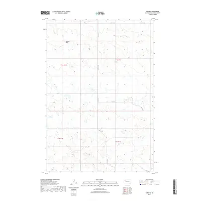
2017 Map of Sorum SE
USGS Topo · Published 2017About this map
Haystack Butte rises as a prominent landmark in this section of Perkins County, anchoring a landscape defined by seasonal drainages and vast rural reaches. The hydrology of the region is traced by the winding paths of Antelope Cr and Dog Cr, which create subtle variations in the local topography. This 2017 survey shows a network of section-line roads and named routes including Prairie City Rd, Peggy Creek Rd, and Antelope Rd, illustrating the structured land division of the High Plains. The map captures the quiet character of the South Dakota prairie, where the placement of cattle guards and fencelines often dictates the flow of movement across the wide-open township and range blocks.
Find a feature on this map
12 named features on this map. Tap any name to fly to it.
Don’t see what you’re looking for? This feature index may not catch every label — zoom into the map to look around manually.
Map Details
Editions of this 2017 Sorum SE Map
This is the sole edition of this map. No revisions or reprints were ever made.
Other maps of this area

1951 · Imogene
USGS Topo · 1:24,000

1954 · Lemmon
USGS Topo · 1:250,000

1957 · Lemmon
USGS Topo · 1:250,000

1980 · Zeona
USGS Topo · 1:25,000

1983 · Sorum NE
USGS Topo · 1:24,000
1983 · Sorum
USGS Topo · 1:24,000

1983 · Date
USGS Topo · 1:24,000

1983 · Sorum SE
USGS Topo · 1:24,000

1983 · Daviston
USGS Topo · 1:24,000
1983 · Sorum SW
USGS Topo · 1:24,000