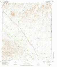
1983 Map of Sosa Peak
USGS Topo · Published 1984About this map
Sosa Peak dominates this arid landscape in Brewster County, marking a high point above a network of desert drainage systems. The topography is defined by the sharp incisions of Big Dark Canyon and Little Dark Canyon, which funnel toward the broader wash of Maravillas Creek. This 1983 survey captures a territory where water management is critical for land use, evidenced by the scattered locations of a Well, a Windmill, and several designated Tank sites used to capture precious runoff.
Find a feature on this map
11 named features on this map. Tap any name to fly to it.
Don’t see what you’re looking for? This feature index may not catch every label — zoom into the map to look around manually.
Map Details
Editions of this 1983 Sosa Peak Map
2 editions found
Other maps of this area

1917 · Santiago Peak
USGS Topo · 1:62,500

1917 · Bone Spring
USGS Topo · 1:62,500

1917 · Hood Spring
USGS Topo · 1:62,500

1918 · Bone Spring
USGS Topo · 1:125,000

1918 · Hood Spring
USGS Topo · 1:62,500

1918 · Santiago Peak
USGS Topo · 1:62,500

1918 · Bone Spring
USGS Topo · 1:62,500

1918 · Nine Point Mesa
USGS Topo · 1:62,500

1920 · Bone Spring
USGS Topo · 1:62,500

1931 · Hood Spring
USGS Topo · 1:62,500