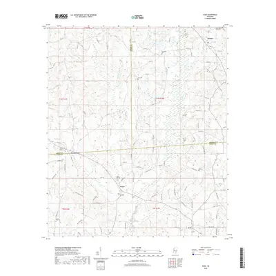
2018 Map of Soso
USGS Topo · Published 2018About this map
Stringer and Soso anchor this survey of the South Mississippi landscape, where the borders of Jasper, Jones, and Smith Counties converge. The area is defined by a dense network of country roads, such as Co RD 10 and Co RD 79, connecting small communities like Gitano and Summerland. This topography is heavily marked by local heritage sites, particularly numerous family and community burial grounds including Knights Mill Cem and Union Line Cem.
Find a feature on this map
105 named features on this map. Tap any name to fly to it.
Don’t see what you’re looking for? This feature index may not catch every label — zoom into the map to look around manually.
Map Details
Editions of this 2018 Soso Map
This is the sole edition of this map. No revisions or reprints were ever made.
Other maps of this area

1953 · Hattiesburg
USGS Topo · 1:250,000

1958 · Hattiesburg
USGS Topo · 1:250,000

1964 · Moss
USGS Topo · 1:24,000

1964 · Laurel West
USGS Topo · 1:24,000

1964 · Lake Como
USGS Topo · 1:24,000

1965 · Hebron
USGS Topo · 1:24,000

1965 · Hot Coffee
USGS Topo · 1:24,000

1974 · Soso
USGS Topo · 1:24,000
1974 · Bay Springs
USGS Topo · 1:24,000

1975 · Taylorsville
USGS Topo · 1:24,000