
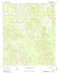
1964 Map of Lake Como
USGS Topo · Published 1965About this map
Lake Como and the neighboring settlement of Acme anchor this mid-century survey of Jasper County, characterized by a dense network of country churches and family burial grounds. The landscape is defined by the winding paths of Tallahoma Creek and Nuakfuppa Creek, where small clearings for homesteads break through the heavy timber. Spiritual and social life in the 1960s is evidenced by the numerous small congregations scattered across the terrain, from Waiters Chapel in the northeast to Blue Ridge Ch in the south.
Find a feature on this map
18 named features on this map. Tap any name to fly to it.
Don’t see what you’re looking for? This feature index may not catch every label — zoom into the map to look around manually.
Map Details
Editions of this 1964 Lake Como Map
2 editions found
Other maps of this area

1953 · Hattiesburg
USGS Topo · 1:250,000

1953 · Meridian
USGS Topo · 1:250,000

1957 · Meridian
USGS Topo · 1:250,000

1958 · Hattiesburg
USGS Topo · 1:250,000

1963 · Waldrup
USGS Topo · 1:24,000

1964 · Moss
USGS Topo · 1:24,000

1964 · Sandersville
USGS Topo · 1:24,000

1965 · Meridian
USGS Topo · 1:250,000

1968 · Louin
USGS Topo · 1:24,000

1970 · Paulding
USGS Topo · 1:24,000