
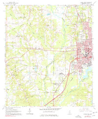
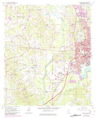
1964 Map of Laurel West
USGS Topo · Published 1965About this map
The western expansion of Laurel is captured here during a period of mid-century growth, bounded by the Tallahala Creek corridor and a network of active rail lines. The urban landscape is anchored by educational and civic institutions like Southeastern Baptist College and Gardiner High Sch, while the city’s industrial roots are visible at Cotton Mill Park. Beyond the Laurel Corporate Boundary, the terrain shifts toward a rural economy marked by various resource extraction sites, including numerous claypits and sandpits dotting the hillsides near Pleasant Ridge.
Find a feature on this map
79 named features on this map. Tap any name to fly to it.
Don’t see what you’re looking for? This feature index may not catch every label — zoom into the map to look around manually.
Map Details
Editions of this 1964 Laurel West Map
3 editions found
Other maps of this area

1953 · Hattiesburg
USGS Topo · 1:250,000

1958 · Hattiesburg
USGS Topo · 1:250,000

1964 · Moss
USGS Topo · 1:24,000

1964 · Sandersville
USGS Topo · 1:24,000

1964 · Laurel East
USGS Topo · 1:24,000

1964 · Ellisville
USGS Topo · 1:24,000

1964 · Lanham
USGS Topo · 1:24,000

1965 · Hebron
USGS Topo · 1:24,000

1965 · Moselle
USGS Topo · 1:24,000

1974 · Soso
USGS Topo · 1:24,000