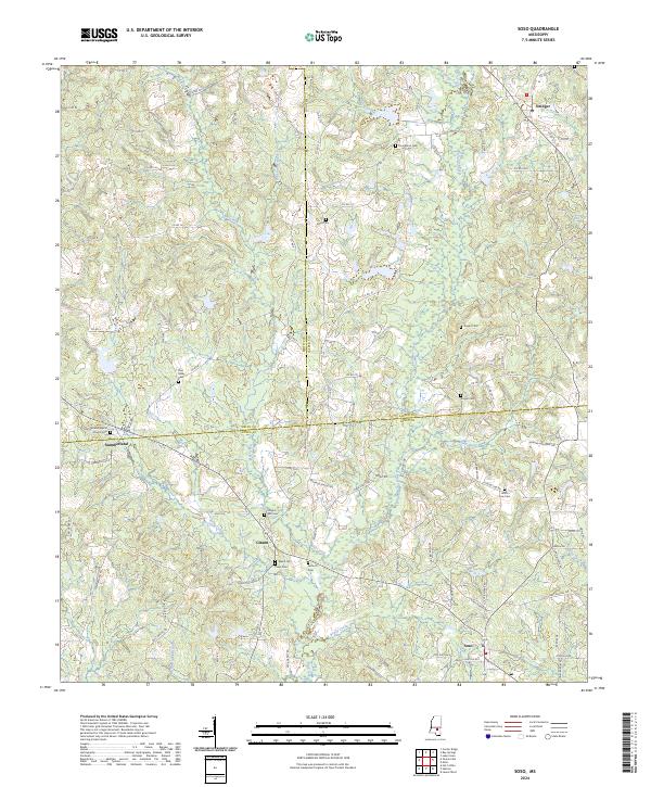
2024 Map of Soso
USGS Topo · Published 2024About this map
Soso and Gitano anchor the southern reaches of this landscape, where the borders of Smith, Jasper, and Jones Counties converge. The area is defined by a dense network of small watercourses, including Mill Creek, Brady Creek, and Panther Branch, which carve through the terrain between small rural communities. The map highlights numerous burial grounds that serve as significant genealogical markers, such as Providence Cem, Knight Cem, and Union Line Cem, indicating a long-established pattern of family settlement. Near the community of Summerland, the Summerland Baptist Church stands as a local landmark. The transition from the northern settlements like Stringer to the southern towns follows established county roads, reflecting a landscape where geography and local history are deeply intertwined around the heads of the Leaf River watershed.
Find a feature on this map
114 named features on this map. Tap any name to fly to it.
Don’t see what you’re looking for? This feature index may not catch every label — zoom into the map to look around manually.
Map Details
Editions of this 2024 Soso Map
This is the sole edition of this map. No revisions or reprints were ever made.
Other maps of this area

1953 · Hattiesburg
USGS Topo · 1:250,000

1958 · Hattiesburg
USGS Topo · 1:250,000

1964 · Moss
USGS Topo · 1:24,000

1964 · Laurel West
USGS Topo · 1:24,000

1964 · Lake Como
USGS Topo · 1:24,000

1965 · Hebron
USGS Topo · 1:24,000

1965 · Hot Coffee
USGS Topo · 1:24,000

1974 · Soso
USGS Topo · 1:24,000
1974 · Bay Springs
USGS Topo · 1:24,000

1975 · Taylorsville
USGS Topo · 1:24,000