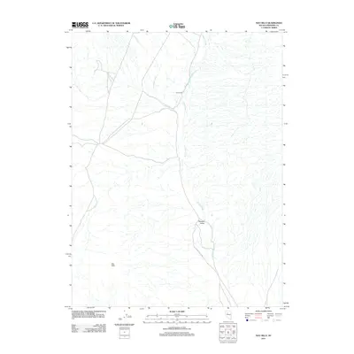
2011 Map of Sou Hills
USGS Topo · Published 2011About this map
Paris Ranch and the small settlement of Pleasant Valley occupy the central drainage basins of this Pershing County landscape. The area is defined by the elevation of the Sou Hills to the southwest, while a network of seasonal watercourses including Rock Creek, Spring Creek, and Cinnabar Creek carve through the basin floor. This 2011 survey captures the remote ranching character of the region, where the primary infrastructure consists of unpaved routes and the S Grass Valley Rd. The map illustrates a traditional Great Basin land use pattern where isolated homesteads and ranching outposts are positioned near the intermittent water sources necessary for high-desert survival.
Find a feature on this map
7 named features on this map. Tap any name to fly to it.
Don’t see what you’re looking for? This feature index may not catch every label — zoom into the map to look around manually.
Map Details
Editions of this 2011 Sou Hills Map
This is the sole edition of this map. No revisions or reprints were ever made.
Other maps of this area

1932 · Sonoma Range
USGS Topo · 1:250,000

1939 · Sonoma Range
USGS Topo · 1:250,000

1955 · Winnemucca
USGS Topo · 1:250,000

1958 · Winnemucca
USGS Topo · 1:250,000
1961 · Kyle Hot Springs
USGS Topo · 1:62,500

1961 · Mt. Tobin
USGS Topo · 1:62,500

1961 · Cain Mountain
USGS Topo · 1:62,500

1961 · Fencemaker
USGS Topo · 1:62,500

1962 · Winnemucca
USGS Topo · 1:250,000

1982 · Fish Creek Mts
USGS Topo · 1:100,000