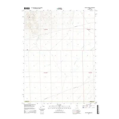
2014 Map of Sou Hot Springs
USGS Topo · Published 2014About this map
Sou Hot Springs and Seven Devils Springs punctuate the arid landscape of the Sou Hills in this 2014 survey. The topography is defined by the significant elevation of the hills to the northwest, dropping away toward the drainage of Jersey Valley Wash. This area of Churchill and Pershing counties is marked by its reliance on intermittent water sources like Spring Cr and the access provided by long desert corridors such as Dixie Valley Rd and Jersey Valley Rd. The map illustrates the characteristic basin-and-range geography of Nevada, where Sou Canyon carves through the uplands before opening into the wider valley floor. The placement of these springs and the primary road network reflect the essential routes through the Great Basin terrain.
Find a feature on this map
14 named features on this map. Tap any name to fly to it.
Don’t see what you’re looking for? This feature index may not catch every label — zoom into the map to look around manually.
Map Details
Editions of this 2014 Sou Hot Springs Map
This is the sole edition of this map. No revisions or reprints were ever made.
Other maps of this area

1932 · Sonoma Range
USGS Topo · 1:250,000

1939 · Sonoma Range
USGS Topo · 1:250,000

1955 · Millett
USGS Topo · 1:250,000

1955 · Winnemucca
USGS Topo · 1:250,000

1958 · Winnemucca
USGS Topo · 1:250,000

1959 · Millett
USGS Topo · 1:250,000

1961 · Cain Mountain
USGS Topo · 1:62,500

1961 · Fencemaker
USGS Topo · 1:62,500

1962 · Winnemucca
USGS Topo · 1:250,000

1966 · Humboldt Salt Marsh
USGS Topo · 1:62,500