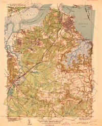
1940 Map of South Amboy
USGS Topo · Published 1940About this map
Industrial and maritime activity dominates the landscape where the Raritan River meets Raritan Bay, surveyed just before the United States entered World War II. The northern reach of the map is defined by the heavy infrastructure of South Amboy and the neighboring Arsenal, while the Raritan River RR and Pennsylvania RR lines create a dense web of transportation supporting the local clay and manufacturing sectors. Inland, the character shifts toward small-scale settlements and rural school districts such as Browntown Sch and School No 5.
Find a feature on this map
56 named features on this map. Tap any name to fly to it.
Don’t see what you’re looking for? This feature index may not catch every label — zoom into the map to look around manually.
Map Details
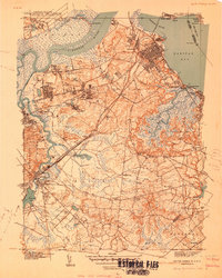
Editions of this 1940 South Amboy Map
2 editions found
Other maps of this area

1888 · Plainfield
USGS Topo · 1:62,500

1888 · New Brunswick
USGS Topo · 1:62,500

1888 · Sandy Hook
USGS Topo · 1:62,500

1893 · New Brunswick
USGS Topo · 1:62,500

1893 · Plainfield
USGS Topo · 1:62,500

1893 · Sandy Hook
USGS Topo · 1:62,500

1898 · Plainfield
USGS Topo · 1:62,500

1898 · Staten Island
USGS Topo · 1:62,500

1900 · Passaic
USGS Topo · 1:125,000

1900 · Staten Island
USGS Topo · 1:62,500