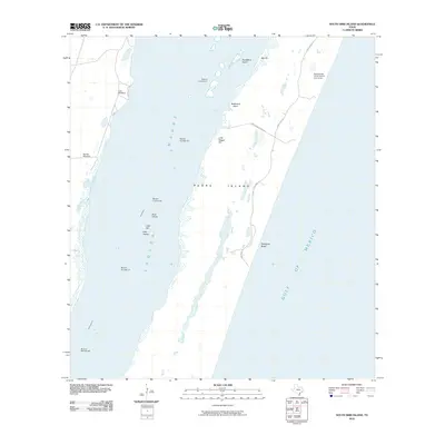
2010 Map of South Bird Island
USGS Topo · Published 2010About this map
Padre Island divides the open waters of the Gulf of Mexico from the shallow reaches of Laguna Madre, forming a landscape of shifting sands and critical maritime navigation. This coastal environment is defined by low-relief terrain features such as Big Hill, Little Dagger Hill, and South Bird Island, which offer vital orientation points in a region of tidal flats and marshes. Human presence is sparse, marked primarily by the Dunn Ranch - A1541 Novillo Line Camp and scattered utility markers like Lobo Windmill and Novilla Windmill. The Intracoastal Waterway cuts through the western waters, supported by a series of navigational aids including Beacon Number 57 and Beacon Number 83. Recreational and access points such as Malaquite Beach and Birdisland Basin connect to the mainland via Park Road 22, showing the balance between conservation and coastal access during the early 21st century.
Find a feature on this map
24 named features on this map. Tap any name to fly to it.
Don’t see what you’re looking for? This feature index may not catch every label — zoom into the map to look around manually.
Map Details
Editions of this 2010 South Bird Island Map
This is the sole edition of this map. No revisions or reprints were ever made.
Other maps of this area

1925 · Oso Creek
USGS Topo · 1:62,500

1950 · Corpus Christi
USGS Topo · 1:250,000

1951 · South Bird Island
USGS Topo · 1:24,000

1951 · South Bird Island SE
USGS Topo · 1:24,000

1951 · South Bird Island NW
USGS Topo · 1:24,000

1951 · Point Of Rocks
USGS Topo · 1:24,000

1951 · Crane Islands SW
USGS Topo · 1:24,000

1951 · Oso Creek
USGS Topo · 1:62,500

1951 · Crane Islands
USGS Topo · 1:62,500

1951 · South Bird Island
USGS Topo · 1:62,500