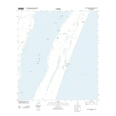
2013 Map of South Bird Island
USGS Topo · Published 2013About this map
Laguna Madre dominates this coastal landscape, separating the mainland from the slender barrier of North Padre Island. In this contemporary 2013 survey, the area is defined by a sparse network of ranching and maritime infrastructure. The Dunn Ranch -A1541 Novillo Line Camp and scattered markers like Lobo Windmill and Novilla Windmill speak to the region's enduring cattle-ranching heritage. Along the coast, the Malaquite Beach Development and Malaquite Beach mark the intersection of shoreline recreation and the expansive Gulf of Mexico. Navigation is meticulously charted through a series of offshore markers, including Beacon Number 57 and Beacon Number 83, which guide vessels through the shallow waters and around features like South Bird Island and the sheltered Bird Island Basin.
Find a feature on this map
22 named features on this map. Tap any name to fly to it.
Don’t see what you’re looking for? This feature index may not catch every label — zoom into the map to look around manually.
Map Details
Editions of this 2013 South Bird Island Map
This is the sole edition of this map. No revisions or reprints were ever made.
Other maps of this area

1925 · Oso Creek
USGS Topo · 1:62,500

1950 · Corpus Christi
USGS Topo · 1:250,000

1951 · South Bird Island
USGS Topo · 1:24,000

1951 · South Bird Island SE
USGS Topo · 1:24,000

1951 · South Bird Island NW
USGS Topo · 1:24,000

1951 · Point Of Rocks
USGS Topo · 1:24,000

1951 · Crane Islands SW
USGS Topo · 1:24,000

1951 · Oso Creek
USGS Topo · 1:62,500

1951 · Crane Islands
USGS Topo · 1:62,500

1951 · South Bird Island
USGS Topo · 1:62,500