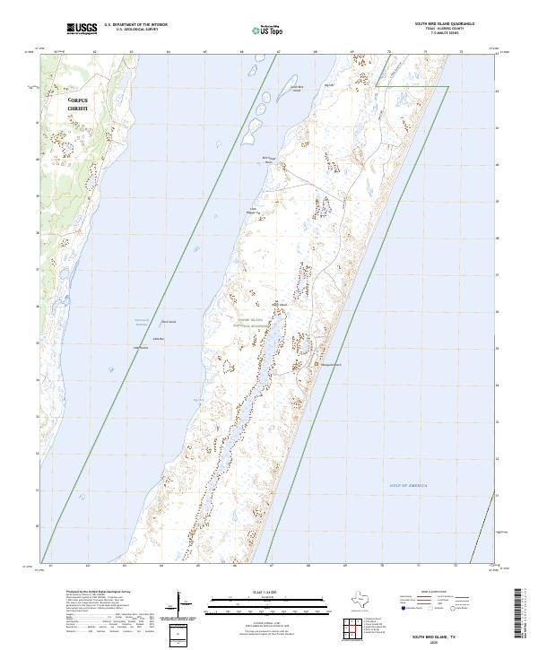
2025 Map of South Bird Island
USGS Topo · Published 2025About this map
Padre Island National Seashore dominates this coastal landscape, protecting a massive stretch of barrier island terrain along the Texas Gulf Coast. This modern survey illustrates the narrow, complex geography of Padre Island, where the land is punctuated by distinctive rises such as Big Hill and Little Dagger Hill. To the west, the Intracoastal Waterway serves as a vital maritime artery, separating the island from the mainland near the southern reaches of Corpus Christi. The map details the transition from the open waters of the Gulf of America to sheltered features like Big Cove and Little Harbor. Recreational and environmental sites are well-documented, including the access point at Malaquite Beach and the boating hub of Bird Island Basin, alongside specialized paths like the Nature Trail that weave through the dunes.
Find a feature on this map
17 named features on this map. Tap any name to fly to it.
Don’t see what you’re looking for? This feature index may not catch every label — zoom into the map to look around manually.
Map Details
Editions of this 2025 South Bird Island Map
This is the sole edition of this map. No revisions or reprints were ever made.
Other maps of this area

1925 · Oso Creek
USGS Topo · 1:62,500

1950 · Corpus Christi
USGS Topo · 1:250,000

1951 · South Bird Island
USGS Topo · 1:24,000

1951 · South Bird Island SE
USGS Topo · 1:24,000

1951 · South Bird Island NW
USGS Topo · 1:24,000

1951 · Point Of Rocks
USGS Topo · 1:24,000

1951 · Crane Islands SW
USGS Topo · 1:24,000

1951 · Oso Creek
USGS Topo · 1:62,500

1951 · Crane Islands
USGS Topo · 1:62,500

1951 · South Bird Island
USGS Topo · 1:62,500