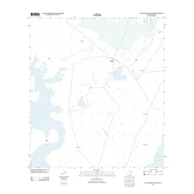
2013 Map of South Bird Island NW
USGS Topo · Published 2013About this map
Ojo de Angua and Noche Bueno anchor a landscape defined by ranching infrastructure and intermittent water sources in this coastal section of South Texas. The interior is characterized by a sparse distribution of family-named wells, such as Estrella Well, Palomas Well, and Tanques de Luis Well, which suggest the critical importance of groundwater for livestock in this arid environment. The map shows the transition from these inland points toward the brackish wetlands and inlets of the Gulf coast.
Find a feature on this map
18 named features on this map. Tap any name to fly to it.
Don’t see what you’re looking for? This feature index may not catch every label — zoom into the map to look around manually.
Map Details
Editions of this 2013 South Bird Island NW Map
This is the sole edition of this map. No revisions or reprints were ever made.
Other maps of this area

1924 · Petronilla
USGS Topo · 1:62,500

1925 · Oso Creek
USGS Topo · 1:62,500

1928 · Sarita
USGS Topo · 1:125,000

1950 · Corpus Christi
USGS Topo · 1:250,000

1951 · South Bird Island
USGS Topo · 1:24,000

1951 · South Bird Island SE
USGS Topo · 1:24,000

1951 · South Bird Island NW
USGS Topo · 1:24,000

1951 · Point Of Rocks
USGS Topo · 1:24,000

1951 · Kleberg Point
USGS Topo · 1:24,000

1951 · Riviera Beach NE
USGS Topo · 1:24,000