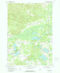
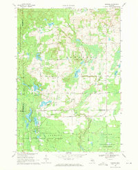
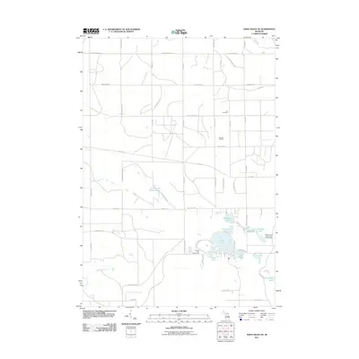
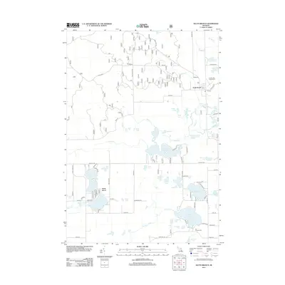
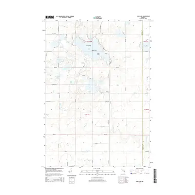
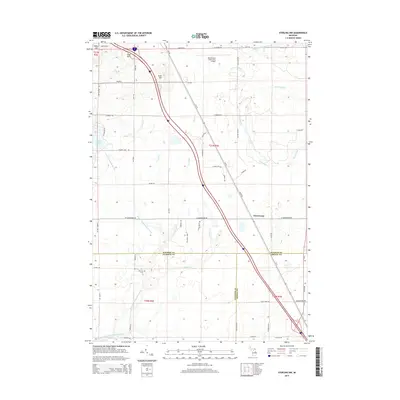
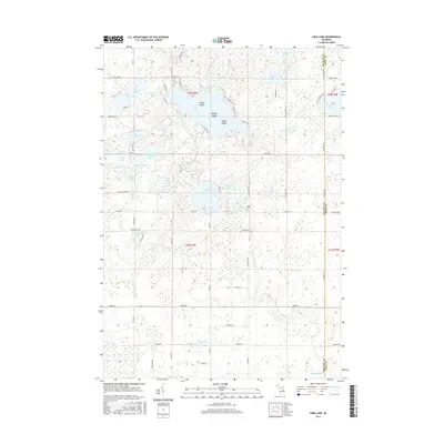
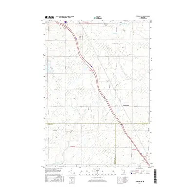
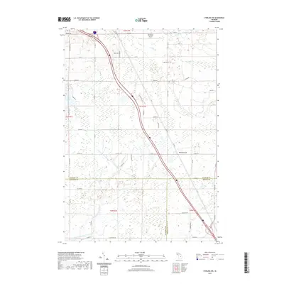
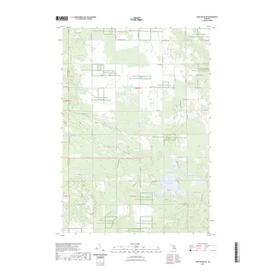
1968 Map of South Branch
USGS Topo · Published 1989About this map
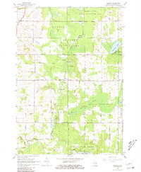
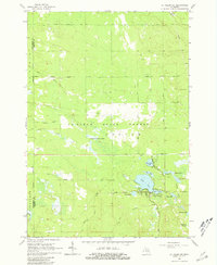
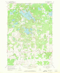
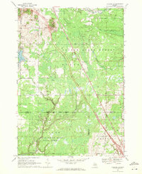
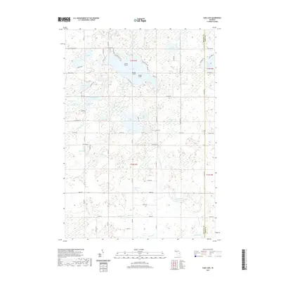
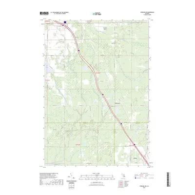
The Huron National Forest and Ogemaw State Forest dominate this late-1960s landscape, where glacial geology is expressed through the Maltby Hills and an intricate network of kettle lakes. The settlement of South Branch serves as a small hub near the Ogemaw and Iosco county line, featuring the Timbers Sky Ranch Airfield and the Oak Grove Cem. Water defines the region, from the sprawling Maltby Swamp to the recreational clusters at Shady Shores on the banks of George Lake. A complex system of streams, including Au Sable Creek and Augustina Creek, connects numerous water bodies like North Dease Lake and Au Sable Lake. This survey illustrates a period when the area was maturing as a destination for outdoor recreation and seasonal residences, with local infrastructure supported by roads such as Mack Road and Rose City Road.
Find a feature on this map
57 named features on this map. Tap any name to fly to it.
Don’t see what you’re looking for? This feature index may not catch every label — zoom into the map to look around manually.
Map Details
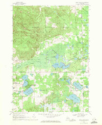
Editions of this 1968 South Branch Map
2 editions found
Historical Maps of Plainfield Township Through Time
48 maps found
1965 Damon
Ogemaw County, MI
1965 Ogemaw Springs
Ogemaw County, MI
1965 Selkirk
Ogemaw County, MI
1965 St. Helen NE
Ogemaw County, MI
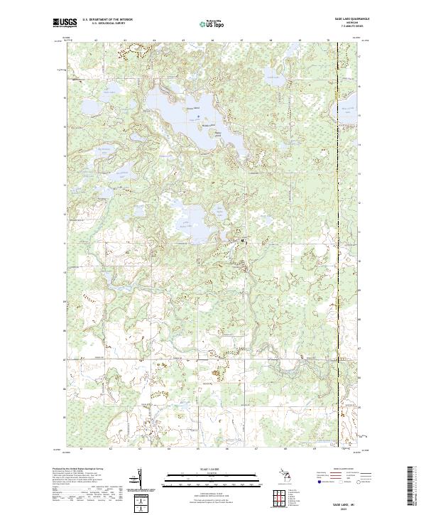
1968 Sage Lake
Ogemaw County, MI
1968 South Branch
Ogemaw County, MI
1968 Sterling NW
Ogemaw County, MI
1969 Edwards
Ogemaw County, MI
2011 Edwards
Ogemaw County, MI
2011 Ogemaw Springs
Ogemaw County, MI
2011 Sage Lake
Ogemaw County, MI
2011 Saint Helen NE
Ogemaw County, MI
2011 Selkirk
Ogemaw County, MI
2011 Sterling NW
Ogemaw County, MI
2012 Damon
Ogemaw County, MI
2012 South Branch
Ogemaw County, MI
2014 Damon
Ogemaw County, MI
2014 Edwards
Ogemaw County, MI
2014 Ogemaw Springs
Ogemaw County, MI
2014 Sage Lake
Ogemaw County, MI
2014 Saint Helen NE
Ogemaw County, MI
2014 Selkirk
Ogemaw County, MI
2014 South Branch
Ogemaw County, MI
2014 Sterling NW
Ogemaw County, MI
2017 Damon
Ogemaw County, MI
2017 Edwards
Ogemaw County, MI
2017 Ogemaw Springs
Ogemaw County, MI
2017 Sage Lake
Ogemaw County, MI
2017 Saint Helen NE
Ogemaw County, MI
2017 Selkirk
Ogemaw County, MI
2017 South Branch
Ogemaw County, MI
2017 Sterling NW
Ogemaw County, MI
2019 Damon
Ogemaw County, MI
2019 Edwards
Ogemaw County, MI
2019 Ogemaw Springs
Ogemaw County, MI
2019 Sage Lake
Ogemaw County, MI
2019 Saint Helen NE
Ogemaw County, MI
2019 Selkirk
Ogemaw County, MI
2019 South Branch
Ogemaw County, MI
2019 Sterling NW
Ogemaw County, MI
2023 Damon
Ogemaw County, MI
2023 Edwards
Ogemaw County, MI
2023 Ogemaw Springs
Ogemaw County, MI
2023 Sage Lake
Ogemaw County, MI
2023 Saint Helen NE
Ogemaw County, MI
2023 Selkirk
Ogemaw County, MI
2023 South Branch
Ogemaw County, MI
2023 Sterling NW
Ogemaw County, MI
Featured Locations
- Plainfield Township, MI
- Goodar Township, MI
- Hill Township, MI
- Shady Shores, Hill Township
- South Branch, Goodar Township