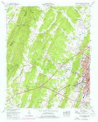
1965 Map of South Cleveland
USGS Topo · Published 1977About this map
Cleveland and its southern suburbs emerge as a growing commercial and educational hub during this mid-century period, centered around the Bradley County Courthouse. The landscape is a mix of urban development and rural tradition, where historic institutions like the Bachman Memorial Childrens Home sit near the expanding campus of Cleveland State Community College. The residential growth of Annadale and South Cleveland contrasts with the surrounding agricultural valleys, where life still revolves around local centers like Prospect and numerous country churches, including Bancroft Ch and Elkmont Ch.
Find a feature on this map
63 named features on this map. Tap any name to fly to it.
Don’t see what you’re looking for? This feature index may not catch every label — zoom into the map to look around manually.
Map Details
Editions of this 1965 South Cleveland Map
2 editions found
Other maps of this area

1886 · Cleveland
USGS Topo · 1:125,000

1888 · Chattanooga
USGS Topo · 1:125,000

1892 · Cleveland
USGS Topo · 1:125,000

1893 · Chattanooga
USGS Topo · 1:125,000

1895 · Cleveland
USGS Topo · 1:125,000

1901 · Cleveland
USGS Topo · 1:125,000

1935 · East Cleveland
USGS Topo · 1:24,000

1935 · Mc Donald
USGS Topo · 1:24,000

1935 · Felker
USGS Topo · 1:24,000

1935 · Snow Hill
USGS Topo · 1:24,000