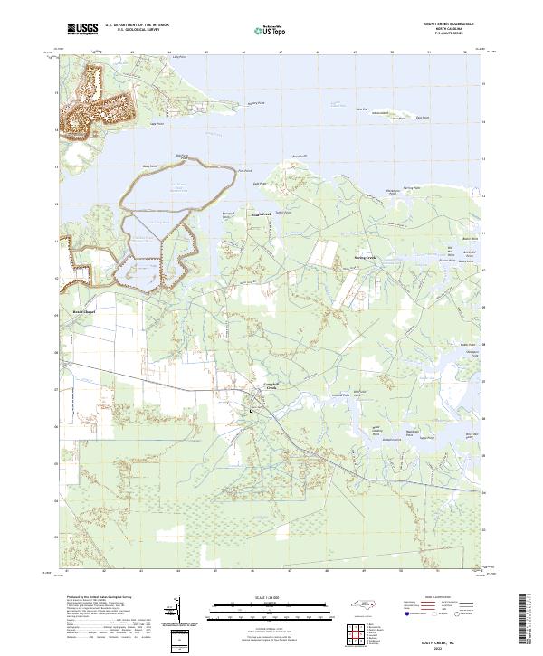
2022 Map of South Creek
USGS Topo · Published 2022About this map
The tidal landscape of South Creek and its many winding tributaries defines this portion of the Beaufort coast. The area is characterized by an intricate network of guts and points, where settlements like Spring Creek and Campbell Creek sit among the wetlands. Evidence of the region's industrial and agricultural history is found in labels for Old Mill Point and Brick Mill Point, alongside the significant footprint of the T G Slimes Pond Number One and T G Clay Pond systems.
Find a feature on this map
128 named features on this map. Tap any name to fly to it.
Don’t see what you’re looking for? This feature index may not catch every label — zoom into the map to look around manually.
Map Details
Editions of this 2022 South Creek Map
This is the sole edition of this map. No revisions or reprints were ever made.
Other maps of this area

1950 · Vandemere
USGS Topo · 1:24,000

1950 · Lowland
USGS Topo · 1:24,000

1950 · South Creek
USGS Topo · 1:24,000

1950 · Jones Bay
USGS Topo · 1:24,000

1950 · Aurora
USGS Topo · 1:24,000

1951 · Bath
USGS Topo · 1:24,000

1951 · Ransomville
USGS Topo · 1:24,000

1951 · Pamlico Beach
USGS Topo · 1:24,000

1953 · Rocky Mount
USGS Topo · 1:250,000

1954 · Rocky Mount
USGS Topo · 1:250,000