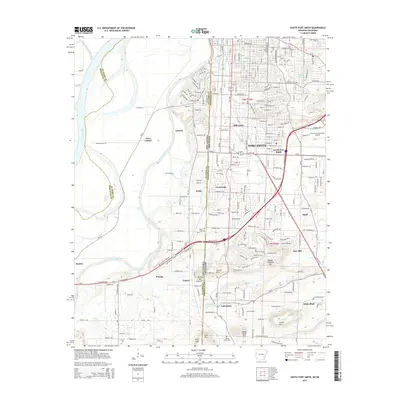
2014 Map of South Fort Smith
USGS Topo · Published 2014About this map
Fort Smith and its southern extension across the Oklahoma Arkansas border define this transition from urban centers to the wooded ridges of the Arkansas River Valley. The terrain is marked by significant elevation changes, rising from the banks of the Poteau River and Arkansas River to named heights such as George Mtn and Brooks Stephens Mtn. This period shows the continued industrial and transport presence in the region, with the Fort Smith Municipal Airport anchoring the east while a Saw Mill and several quarries operate near White Bluff. Local history is preserved in several burial grounds, including the historic Oak Cem and the more remote White Bluff Cem. The map tracks the shift from the dense street grids of South Fort Smith to smaller settlements like Arkoma, Pocola, and Enterprise, where the land begins to follow the natural contours of Cedar Cr and Massard Cr.
Find a feature on this map
58 named features on this map. Tap any name to fly to it.
Don’t see what you’re looking for? This feature index may not catch every label — zoom into the map to look around manually.
Map Details
Editions of this 2014 South Fort Smith Map
This is the sole edition of this map. No revisions or reprints were ever made.
Other maps of this area

1879 · Fort Smith
USGS Topo · 1:62,500

1887 · Van Buren
USGS Topo · 1:62,500

1887 · Greenwood
USGS Topo · 1:62,500

1890 · Fort Smith
USGS Topo · 1:125,000

1900 · Sallisaw
USGS Topo · 1:125,000

1911 · Sallisaw
USGS Topo · 1:125,000

1943 · Fort Smith
USGS Topo · 1:125,000

1946 · Fort Smith
USGS Topo · 1:250,000

1947 · Van Buren
USGS Topo · 1:62,500

1947 · Greenwood
USGS Topo · 1:62,500