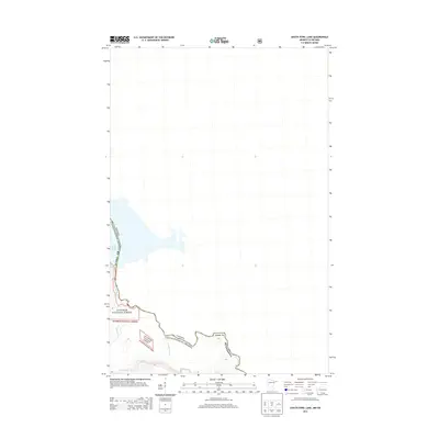
2013 Map of South Fowl Lake
USGS Topo · Published 2013About this map
South Fowl Lake dominates this boundary landscape where the international border separates Cook County, Minnesota from Ontario, Canada. The terrain is defined by the significant hydrological network of the Pigeon River and Stump River, which carve through the heavily forested regions protected within the Superior National Forest. This 2013 survey provides a clear view of the water bodies and topographical contours that have historically dictated travel and logging routes along the borderlands. The presence of Portage Brook underscores the importance of traditional water-and-land transit paths in this part of the Arrowhead Region, where the land remains largely undeveloped and focused on conservation and resource management.
Find a feature on this map
8 named features on this map. Tap any name to fly to it.
Don’t see what you’re looking for? This feature index may not catch every label — zoom into the map to look around manually.
Map Details
Editions of this 2013 South Fowl Lake Map
This is the sole edition of this map. No revisions or reprints were ever made.
Other maps of this area

1954 · Two Harbors
USGS Topo · 1:250,000

1957 · Two Harbors
USGS Topo · 1:250,000

1957 · Quetico
USGS Topo · 1:250,000

1958 · Two Harbors
USGS Topo · 1:250,000

1958 · Hancock
USGS Topo · 1:250,000

1959 · Mineral Center
USGS Topo · 1:24,000

1959 · Pine Lake East
USGS Topo · 1:24,000

1959 · Tom Lake
USGS Topo · 1:24,000

1959 · Fort William
USGS Topo · 1:250,000

1960 · Hancock
USGS Topo · 1:250,000