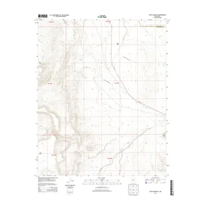
2013 Map of South Garcia SE
USGS Topo · Published 2013About this map
Laguna Pueblo Springs and the nearby Laguna Pueblo Seeps highlight the critical role of water in this high-desert region of New Mexico. The landscape is defined by massive geologic formations including Mesa Lucero on the western edge and Black Mesa in the north, which together dictate the course of ephemeral drainages like Arroyo Garcia. The Rio Puerco meanders through the eastern portion of the terrain, crossing the boundary between Bernalillo and Valencia counties. Transportation in the area relies on a network of tribal and state routes, specifically Indian Service Route 549 and Indian Service Route 548, which intersect the primary corridor of NM-6. This 2013 survey illustrates a sparsely populated but geographically significant area where land use is closely tied to the natural boundaries of the desert mesas and traditional Laguna Pueblo lands.
Find a feature on this map
18 named features on this map. Tap any name to fly to it.
Don’t see what you’re looking for? This feature index may not catch every label — zoom into the map to look around manually.
Map Details
Editions of this 2013 South Garcia SE Map
This is the sole edition of this map. No revisions or reprints were ever made.
Other maps of this area

1917 · Cerro Verde
USGS Topo · 1:125,000

1952 · Belen NW
USGS Topo · 1:24,000

1952 · Rio Puerco
USGS Topo · 1:24,000

1952 · Dalies NW
USGS Topo · 1:24,000

1954 · South Garcia
USGS Topo · 1:24,000

1954 · South Garcia SE
USGS Topo · 1:24,000

1954 · Socorro
USGS Topo · 1:250,000

1956 · South Garcia
USGS Topo · 1:62,500

1956 · Mesa Aparejo
USGS Topo · 1:62,500

1958 · Socorro
USGS Topo · 1:250,000