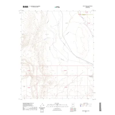
2023 Map of South Garcia SE
USGS Topo · Published 2023About this map
Laguna Pueblo Springs and Laguna Pueblo Seeps sit at the center of this high-desert landscape, where the seasonal waters of Arroyo Garcia cut through the terrain. The map documents a rugged topography defined by massive formations like Mesa Lucero to the west and the isolated Hidden Mountain in the southeast. This modern survey illustrates the persistent importance of limited water sources and indigenous access routes, such as Indian Svc Rte 548, in a region where the Rio Puerco defines the county line between Bernalillo and Valencia. The contrast between the flat expanses of Black Mesa and the deep drainage of the arroyos highlights the geological character of this part of the Rio Grande basin.
Find a feature on this map
16 named features on this map. Tap any name to fly to it.
Don’t see what you’re looking for? This feature index may not catch every label — zoom into the map to look around manually.
Map Details
Editions of this 2023 South Garcia SE Map
This is the sole edition of this map. No revisions or reprints were ever made.
Other maps of this area

1917 · Cerro Verde
USGS Topo · 1:125,000

1952 · Belen NW
USGS Topo · 1:24,000

1952 · Rio Puerco
USGS Topo · 1:24,000

1952 · Dalies NW
USGS Topo · 1:24,000

1954 · South Garcia
USGS Topo · 1:24,000

1954 · South Garcia SE
USGS Topo · 1:24,000

1954 · Socorro
USGS Topo · 1:250,000

1956 · South Garcia
USGS Topo · 1:62,500

1956 · Mesa Aparejo
USGS Topo · 1:62,500

1958 · Socorro
USGS Topo · 1:250,000