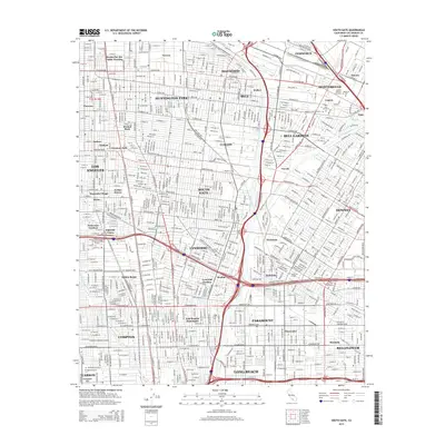
2015 Map of South Gate
USGS Topo · Published 2015About this map
The Los Angeles River and Rio Hondo carve through this densely populated corridor of Southeast Los Angeles County, defining the industrial and residential boundaries of early 21st-century Southern California. This 2015 survey reveals the complex urban landscape of South Gate, Lynwood, and Huntington Park, where the Union Pacific RR and major thoroughfares like Firestone Blvd facilitate the movement of goods and people.
Find a feature on this map
126 named features on this map. Tap any name to fly to it.
Don’t see what you’re looking for? This feature index may not catch every label — zoom into the map to look around manually.
Map Details
Editions of this 2015 South Gate Map
This is the sole edition of this map. No revisions or reprints were ever made.
Other maps of this area

1894 · Los Angeles
USGS Topo · 1:62,500

1896 · Pasadena
USGS Topo · 1:62,500

1896 · Redondo
USGS Topo · 1:62,500

1896 · Santa Monica
USGS Topo · 1:62,500

1896 · Downey
USGS Topo · 1:62,500

1898 · Santa Monica
USGS Topo · 1:62,500

1899 · Downey
USGS Topo · 1:62,500

1900 · Pasadena
USGS Topo · 1:62,500

1900 · Los Angeles
USGS Topo · 1:62,500

1901 · Southern California Sheet No. 1
USGS Topo · 1:250,000