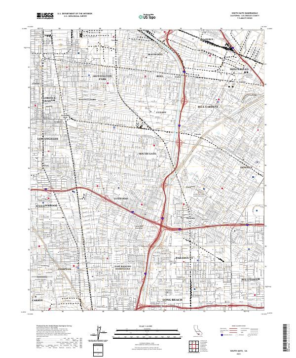
2021 Map of South Gate
USGS Topo · Published 2021About this map
The Los Angeles River and Rio Hondo converge in this densely developed corridor of southeast Los Angeles County, defining the geography of industrial and residential hubs. This contemporary survey details a complex urban grid spanning from the rail-oriented enclave of Commerce and Maywood down to the civic centers of Compton and Paramount. The map is particularly useful for genealogical research, as it identifies several specialized burial grounds near the Montebello border, including the Russian Molokan Cem and Mount Olive Memorial Park Jewish Cem.
Find a feature on this map
56 named features on this map. Tap any name to fly to it.
Don’t see what you’re looking for? This feature index may not catch every label — zoom into the map to look around manually.
Map Details
Editions of this 2021 South Gate Map
This is the sole edition of this map. No revisions or reprints were ever made.
Other maps of this area

1894 · Los Angeles
USGS Topo · 1:62,500

1896 · Pasadena
USGS Topo · 1:62,500

1896 · Redondo
USGS Topo · 1:62,500

1896 · Santa Monica
USGS Topo · 1:62,500

1896 · Downey
USGS Topo · 1:62,500

1898 · Santa Monica
USGS Topo · 1:62,500

1899 · Downey
USGS Topo · 1:62,500

1900 · Pasadena
USGS Topo · 1:62,500

1900 · Los Angeles
USGS Topo · 1:62,500

1901 · Southern California Sheet No. 1
USGS Topo · 1:250,000