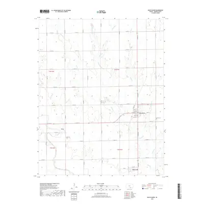
2018 Map of South Haven
USGS Topo · Published 2018About this map
The town of South Haven serves as the central hub of this agricultural landscape in Sumner County, Kansas. Located at the intersection of several regional routes, the town grid is clearly defined by streets such as N Main St, W Stuart St, and Camp St. To the south, the settlement of Hunnewell sits near the winding course of Shoo Fly Cr, while the community of Drury is positioned to the west. This area of the Kansas prairie is characterized by a dense network of section-line roads and numerous waterways, including Spring Creek and Antelope Creek, which drain the surrounding farmland. Genealogists will find particular value in the locations of local burial grounds like Rose Hill Cem and Godel Cem, which remain as permanent markers of the area's rural heritage.
Find a feature on this map
50 named features on this map. Tap any name to fly to it.
Don’t see what you’re looking for? This feature index may not catch every label — zoom into the map to look around manually.
Map Details
Editions of this 2018 South Haven Map
This is the sole edition of this map. No revisions or reprints were ever made.
Other maps of this area

1889 · Caldwell
USGS Topo · 1:125,000

1890 · Wellington
USGS Topo · 1:125,000

1893 · Caldwell
USGS Topo · 1:125,000

1897 · Caldwell
USGS Topo · 1:125,000

1955 · Wichita
USGS Topo · 1:250,000

1955 · Enid
USGS Topo · 1:250,000

1958 · Enid
USGS Topo · 1:250,000

1958 · Wichita
USGS Topo · 1:250,000

1964 · South Haven NE
USGS Topo · 1:24,000

1965 · Portland
USGS Topo · 1:24,000