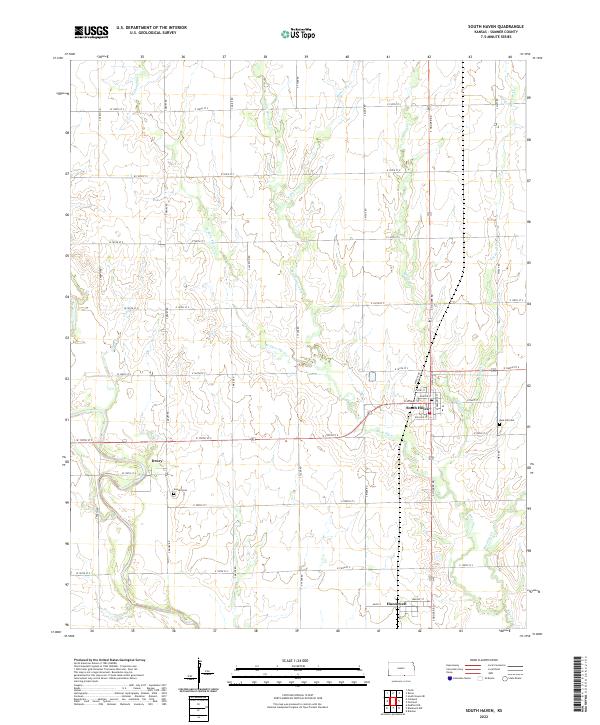
2022 Map of South Haven
USGS Topo · Published 2022About this map
The town of South Haven sits at the heart of this Southern Kansas survey, where a grid of rural section roads divides a landscape defined by the intricate branching of the Shoo Fly Creek system. From W Shoo Fly Cr to Middle Shoo Fly Cr, these waterways cut across the plains toward the Oklahoma border, passing through the smaller settlements of Drury and Hunnewell. Local history is anchored by sites like Goodel Cem and Rose Hill Cem, which mark the community's heritage in Sumner County. The map details the transition from town streets such as Clyde St and Wallace St to the long-reaching corridors of S Hoover Rd and S Drury Rd, illustrating the intersection of residential life and the agriculture-based economy of the region.
Find a feature on this map
49 named features on this map. Tap any name to fly to it.
Don’t see what you’re looking for? This feature index may not catch every label — zoom into the map to look around manually.
Map Details
Editions of this 2022 South Haven Map
This is the sole edition of this map. No revisions or reprints were ever made.
Other maps of this area

1889 · Caldwell
USGS Topo · 1:125,000

1890 · Wellington
USGS Topo · 1:125,000

1893 · Caldwell
USGS Topo · 1:125,000

1897 · Caldwell
USGS Topo · 1:125,000

1955 · Wichita
USGS Topo · 1:250,000

1955 · Enid
USGS Topo · 1:250,000

1958 · Enid
USGS Topo · 1:250,000

1958 · Wichita
USGS Topo · 1:250,000

1964 · South Haven NE
USGS Topo · 1:24,000

1965 · Portland
USGS Topo · 1:24,000