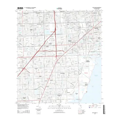
2015 Map of South Miami
USGS Topo · Published 2015About this map
Coral Gables and its surrounding communities are defined by a complex network of artificial waterways and planned residential developments as they appeared in 2015. The landscape is heavily structured by drainage and navigation infrastructure, including the Coral Gables Canal, Snapper Creek Canal, and the Mahi Waterway. These channels connect inland basins like Lake Catalina and Lake Loladero to the Atlantic Ocean via Biscayne Bay. The transition from suburban neighborhoods to the coastal edge is marked by exclusive developments like Gables by the Sea and Gables Estates, which are nestled against the mangroves and inlets of Deering Bay.
Find a feature on this map
81 named features on this map. Tap any name to fly to it.
Don’t see what you’re looking for? This feature index may not catch every label — zoom into the map to look around manually.
Map Details
Editions of this 2015 South Miami Map
This is the sole edition of this map. No revisions or reprints were ever made.
Other maps of this area

1947 · Key Biscayne
USGS Topo · 1:24,000

1948 · Soldier Key
USGS Topo · 1:24,000

1949 · South Miami NW
USGS Topo · 1:24,000

1949 · Key Biscayne
USGS Topo · 1:24,000

1949 · Goulds
USGS Topo · 1:24,000

1949 · Perrine
USGS Topo · 1:24,000

1950 · Hialeah
USGS Topo · 1:24,000

1950 · Miami
USGS Topo · 1:24,000

1950 · South Miami
USGS Topo · 1:24,000

1955 · South Miami NW
USGS Topo · 1:24,000