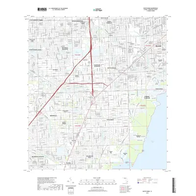
2018 Map of South Miami
USGS Topo · Published 2018About this map
Biscayne Bay forms the eastern boundary of this South Florida survey, where the established neighborhoods of Coral Gables and Coconut Grove meet the Atlantic coast. The landscape is defined by an intricate network of drainage and transport, including the Snapper Creek Canal Number C-2 and the Coral Gables Waterway. Educational and religious institutions are prominent, such as the University of Miami and the Saint John Vianney College Seminary.
Find a feature on this map
84 named features on this map. Tap any name to fly to it.
Don’t see what you’re looking for? This feature index may not catch every label — zoom into the map to look around manually.
Map Details
Editions of this 2018 South Miami Map
This is the sole edition of this map. No revisions or reprints were ever made.
Other maps of this area

1947 · Key Biscayne
USGS Topo · 1:24,000

1948 · Soldier Key
USGS Topo · 1:24,000

1949 · South Miami NW
USGS Topo · 1:24,000

1949 · Key Biscayne
USGS Topo · 1:24,000

1949 · Goulds
USGS Topo · 1:24,000

1949 · Perrine
USGS Topo · 1:24,000

1950 · Hialeah
USGS Topo · 1:24,000

1950 · Miami
USGS Topo · 1:24,000

1950 · South Miami
USGS Topo · 1:24,000

1955 · South Miami NW
USGS Topo · 1:24,000