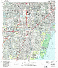
1988 Map of South Miami
USGS Topo · Published 1988About this map
Coral Gables and the surrounding suburban landscape of south Miami-Dade County reflect the rapid urbanization of the late 20th century. This survey documents the intersection of high-speed transit and established residential neighborhoods, notably featuring the Metrorail Sta line cutting through South Miami. The presence of major educational and medical institutions like the Miami-Dade Community College (South Campus), Baptist Hosp, and St Brendan High Sch highlights the area's development into a regional hub.
Find a feature on this map
98 named features on this map. Tap any name to fly to it.
Don’t see what you’re looking for? This feature index may not catch every label — zoom into the map to look around manually.
Map Details
Editions of this 1988 South Miami Map
This is the sole edition of this map. No revisions or reprints were ever made.
Other maps of this area

1947 · Key Biscayne
USGS Topo · 1:24,000

1948 · Soldier Key
USGS Topo · 1:24,000

1949 · South Miami NW
USGS Topo · 1:24,000

1949 · Key Biscayne
USGS Topo · 1:24,000

1949 · Goulds
USGS Topo · 1:24,000

1949 · Perrine
USGS Topo · 1:24,000

1950 · Hialeah
USGS Topo · 1:24,000

1950 · Miami
USGS Topo · 1:24,000

1950 · South Miami
USGS Topo · 1:24,000

1955 · South Miami NW
USGS Topo · 1:24,000