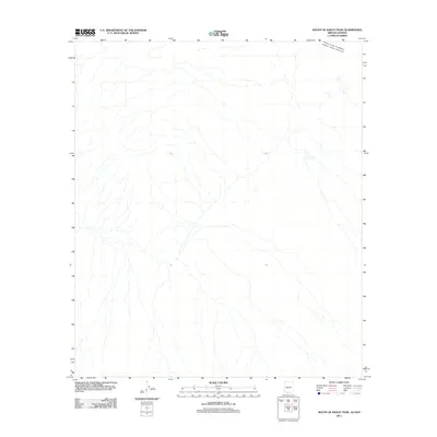
2011 Map of South of Bailey Peak
USGS Topo · Published 2011About this map
The international border between the United States of America Estados Unidos Mexicanos defines the northernmost portion of this 2011 survey, which covers a stretch of the Sonoran landscape in the Chukut Kuk District. This specific map is characterized by its high degree of isolation, focusing primarily on the drainage patterns and ephemeral watercourses that flow through this borderland region. The lack of named settlements or infrastructure reflects the sparse human footprint in this part of Pima County at the time of the survey. The mapping provides a precise look at the arid topography south of Bailey Peak, where the terrain is dominated by complex natural drainage systems crossing the political boundary between Arizona and Sonora.
Find a feature on this map
1 named feature on this map. Tap any name to fly to it.
Don’t see what you’re looking for? This feature index may not catch every label — zoom into the map to look around manually.
Map Details
Editions of this 2011 South of Bailey Peak Map
This is the sole edition of this map. No revisions or reprints were ever made.
Other maps of this area

1954 · Sonoyta
USGS Topo · 1:250,000

1963 · Kom Vo
USGS Topo · 1:62,500

1963 · Lukeville
USGS Topo · 1:250,000

1963 · Diaz Peak
USGS Topo · 1:62,500
1988 · South of Bailey Peak
USGS Topo · 1:24,000
1988 · South of Papago Farms
USGS Topo · 1:24,000
1988 · Bailey Peak
USGS Topo · 1:24,000
1988 · Papago Farms
USGS Topo · 1:24,000
1988 · Menagers Lake
USGS Topo · 1:24,000
1994 · Lukeville
USGS Topo · 1:100,000