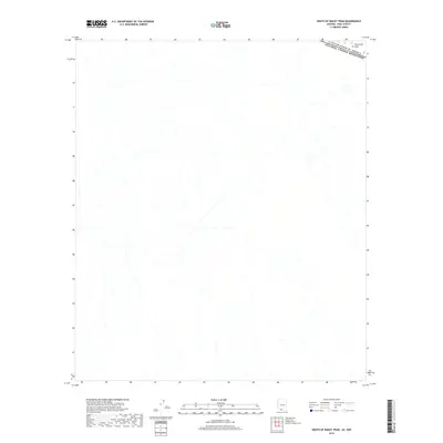
2018 Map of South of Bailey Peak
USGS Topo · Published 2018About this map
The international border between the United States of America and Estados Unidos Mexicanos cuts across the northeastern corner of this remote desert landscape. This 2018 survey documents a region dominated by the expansive topography of The Great Plain, where the terrain is defined by a complex network of dry washes and intermittent drainage channels. The absence of modern infrastructure or named settlements highlights the isolated character of this borderland in Pima County. The map provides a detailed view of the natural hydrology and subtle contour changes in a part of the Arizona desert where the human footprint is primarily limited to the demarcation of the national boundary line.
Find a feature on this map
2 named features on this map. Tap any name to fly to it.
Don’t see what you’re looking for? This feature index may not catch every label — zoom into the map to look around manually.
Map Details
Editions of this 2018 South of Bailey Peak Map
This is the sole edition of this map. No revisions or reprints were ever made.
Other maps of this area

1954 · Sonoyta
USGS Topo · 1:250,000

1963 · Kom Vo
USGS Topo · 1:62,500

1963 · Lukeville
USGS Topo · 1:250,000

1963 · Diaz Peak
USGS Topo · 1:62,500
1988 · South of Bailey Peak
USGS Topo · 1:24,000
1988 · South of Papago Farms
USGS Topo · 1:24,000
1988 · Bailey Peak
USGS Topo · 1:24,000
1988 · Papago Farms
USGS Topo · 1:24,000
1988 · Menagers Lake
USGS Topo · 1:24,000
1994 · Lukeville
USGS Topo · 1:100,000