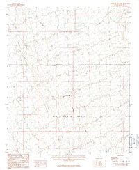
1986 Map of South of Gila Bend
USGS Topo · Published 1986About this map
Luke Air Force Range dominates this landscape south of Gila Bend, illustrating the intersection of military training grounds and the arid Sonoran desert. This mid-1980s provisional study, based on 1979 aerial photography and 1980 field checks, reveals a terrain defined by complex drainage systems and isolated landmarks. Major ephemeral waterways including Quilotosa Wash, Sauceda Wash, and Sand Tank Wash carve through the basin, indicating the natural flow of seasonal runoff across the range. A singular Grave and an Observation Tower serve as distinct human markers in an otherwise utilitarian environment. The survey provides an exacting record of elevation and relief, capturing the topography as it existed during the height of the Cold War era's southwestern training operations.
Find a feature on this map
7 named features on this map. Tap any name to fly to it.
Don’t see what you’re looking for? This feature index may not catch every label — zoom into the map to look around manually.
Map Details
Editions of this 1986 South of Gila Bend Map
This is the sole edition of this map. No revisions or reprints were ever made.
Other maps of this area

1950 · Theba
USGS Topo · 1:62,500

1951 · Gila Bend
USGS Topo · 1:62,500

1951 · Theba
USGS Topo · 1:62,500

1953 · Ajo
USGS Topo · 1:250,000

1957 · Ajo
USGS Topo · 1:250,000

1958 · Ajo
USGS Topo · 1:250,000

1958 · Midway
USGS Topo · 1:62,500

1958 · Hat Mountain
USGS Topo · 1:62,500

1962 · Ajo
USGS Topo · 1:250,000

1963 · Ajo
USGS Topo · 1:250,000