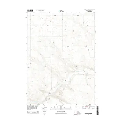
2014 Map of South of Gordon
USGS Topo · Published 2014About this map
The Niobrara River winds through the southern reaches of Sheridan County, carving a distinct valley through the Nebraska sandhills. This landscape is defined by the sharp contrast between the river's path and the surrounding high plains, which are etched with intermittent drainage features like Sand Draw. Local infrastructure reflects the rural nature of the region, anchored by historical markers of community life such as Mt Hope Cem.
Find a feature on this map
21 named features on this map. Tap any name to fly to it.
Don’t see what you’re looking for? This feature index may not catch every label — zoom into the map to look around manually.
Map Details
Editions of this 2014 South of Gordon Map
This is the sole edition of this map. No revisions or reprints were ever made.
Other maps of this area

1955 · Alliance
USGS Topo · 1:250,000

1957 · Alliance
USGS Topo · 1:250,000

1958 · Alliance
USGS Topo · 1:250,000

1969 · Rushville 4 SW
USGS Topo · 1:24,000

1969 · Gordon
USGS Topo · 1:24,000
1969 · Gordon SE
USGS Topo · 1:24,000

1969 · Clinton
USGS Topo · 1:24,000

1969 · Rushville SE
USGS Topo · 1:24,000
1969 · Rushville 4 NE
USGS Topo · 1:24,000
1969 · Rushville 4 NW
USGS Topo · 1:24,000