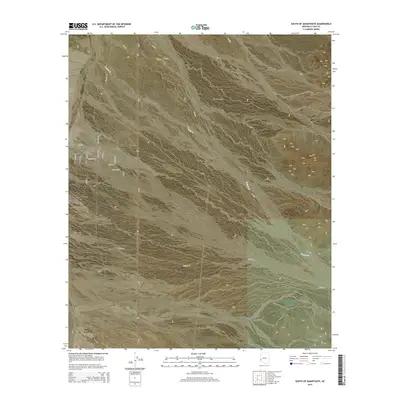
2014 Map of South of Quartzsite
USGS Topo · Published 2014About this map
Quartzsite stands at the northern edge of this arid expanse, where the La Posa Plain stretches southward toward the rugged Livingston Hills. The landscape is defined by the ephemeral drainage of French Cr and a grid of desert tracks and residential streets that mark the southern expansion of the community. Established routes like Old Yuma Rd and Kofa Rd bisect the plain, while newer developments such as La Paz Valley are visible through a cluster of named streets including Sunset Blvd and Staghorn Ln. This 2014 survey captures the intersection of desert wilderness and the growing footprint of Quartzsite, showing how the local road network, including numerous Bureau of Land Management routes like BLM-225, integrates with the older ranching and mining infrastructure of the region.
Find a feature on this map
31 named features on this map. Tap any name to fly to it.
Don’t see what you’re looking for? This feature index may not catch every label — zoom into the map to look around manually.
Map Details
Editions of this 2014 South of Quartzsite Map
This is the sole edition of this map. No revisions or reprints were ever made.
Other maps of this area

1933 · Cunningham Mtn
USGS Topo · 1:48,000

1934 · Trigo Peaks
USGS Topo · 1:48,000

1939 · Trigo Peaks
USGS Topo · 1:62,500

1940 · Dome Rock Mts
USGS Topo · 1:62,500

1942 · Blythe
USGS Topo · 1:250,000

1954 · Salton Sea
USGS Topo · 1:250,000

1954 · Trigo Peaks
USGS Topo · 1:62,500

1955 · Salton Sea
USGS Topo · 1:250,000

1959 · Salton Sea
USGS Topo · 1:250,000

1962 · Quartzsite
USGS Topo · 1:62,500