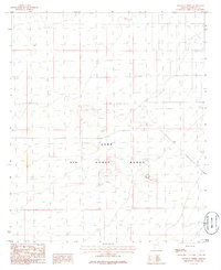
1986 Map of South of Theba
USGS Topo · Published 1986About this map
Luke Air Force Range dominates the terrain south of Gila Bend in this mid-1980s provisional survey. The landscape is defined by its military utility, featuring remote Landing Strips situated among the desert flats and isolated peaks. This map serves as a technical record of the Sonoran Desert's topography during a period when these ranges were essential for tactical training and aviation maneuvers. Unlike typical residential or agricultural maps, the area is characterized by a lack of civilian settlements, focusing instead on the relief of the desert floor and the specific facilities required for aerial operations. The topographic detail captures the sparse, functional nature of the region as it was maintained for defense purposes at the height of the Cold War era.
Find a feature on this map
2 named features on this map. Tap any name to fly to it.
Don’t see what you’re looking for? This feature index may not catch every label — zoom into the map to look around manually.
Map Details
Editions of this 1986 South of Theba Map
This is the sole edition of this map. No revisions or reprints were ever made.
Other maps of this area

1949 · Sentinel
USGS Topo · 1:62,500

1950 · Sentinel
USGS Topo · 1:62,500

1950 · Theba
USGS Topo · 1:62,500

1951 · Theba
USGS Topo · 1:62,500

1953 · Ajo
USGS Topo · 1:250,000

1957 · Ajo
USGS Topo · 1:250,000

1958 · Ajo
USGS Topo · 1:250,000

1958 · Midway
USGS Topo · 1:62,500

1962 · Ajo
USGS Topo · 1:250,000

1963 · Ajo
USGS Topo · 1:250,000