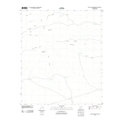
2010 Map of South Pyramid Peak
USGS Topo · Published 2010About this map
The Pyramid Mountains dominate this high-desert landscape in New Mexico, anchored by the prominent South Pyramid Peak and the nearby Pinkey Wright Mountain. This terrain is defined by a network of drainage systems, including South Pyramid Draw and Baker Canyon, which channel seasonal water through the arid environment. A series of catchment features such as China Pond, Middle Tank, and Bigote Tank indicate the vital importance of water management for cattle ranching in this remote section of Hidalgo County. Infrastructure is sparse, primarily consisting of the long-distance Pipeline Rd cutting across the southern flats. The map documents a rugged topography of named summits like Kirk Peak and distinct landforms such as Elephant Back Hill, providing a detailed look at the geographic landmarks used by local land users in the early 21st century.
Find a feature on this map
19 named features on this map. Tap any name to fly to it.
Don’t see what you’re looking for? This feature index may not catch every label — zoom into the map to look around manually.
Map Details
Editions of this 2010 South Pyramid Peak Map
This is the sole edition of this map. No revisions or reprints were ever made.
Other maps of this area

1918 · Playas
USGS Topo · 1:62,500

1918 · Pratt
USGS Topo · 1:62,500

1919 · Pratt
USGS Topo · 1:62,500

1919 · Playas
USGS Topo · 1:62,500

1954 · Silver City
USGS Topo · 1:250,000

1955 · Douglas
USGS Topo · 1:250,000

1958 · Silver City
USGS Topo · 1:250,000

1959 · Douglas
USGS Topo · 1:250,000

1961 · Douglas
USGS Topo · 1:250,000

1962 · Silver City
USGS Topo · 1:250,000