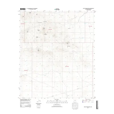
2013 Map of South Pyramid Peak
USGS Topo · Published 2013About this map
The Pyramid Mountains dominate this high-desert landscape in southwestern New Mexico, defined by a series of prominent summits including S Pyramid Peak, Pinkey Wright Mtn, and Kirk Peak. The terrain is deeply incised by complex drainage systems such as Holtkamp Canyon and South Uhl Draw, which channel seasonal water through the Russel Hills toward the desert floor. Human activity is evidenced primarily by ranching and infrastructure, with Muir Ranch situated in the northeast and Pipeline Rd traversing the southern reaches. Water management is critical in this arid environment, marked by isolated features like China Pond, Bigote Tank, and Double Tanks, which serve as vital points for livestock and local wildlife. The map captures the rugged isolation of Hidalgo County, where topographical landmarks like Elephant Back Hill provide essential orientation in the expansive basin and range country.
Find a feature on this map
28 named features on this map. Tap any name to fly to it.
Don’t see what you’re looking for? This feature index may not catch every label — zoom into the map to look around manually.
Map Details
Editions of this 2013 South Pyramid Peak Map
This is the sole edition of this map. No revisions or reprints were ever made.
Other maps of this area

1918 · Playas
USGS Topo · 1:62,500

1918 · Pratt
USGS Topo · 1:62,500

1919 · Pratt
USGS Topo · 1:62,500

1919 · Playas
USGS Topo · 1:62,500

1954 · Silver City
USGS Topo · 1:250,000

1955 · Douglas
USGS Topo · 1:250,000

1958 · Silver City
USGS Topo · 1:250,000

1959 · Douglas
USGS Topo · 1:250,000

1961 · Douglas
USGS Topo · 1:250,000

1962 · Silver City
USGS Topo · 1:250,000